The Atlantic coast
Caravelle Peninsula: trails and practical visiting advice
Caravelle combines dry forest, cliffs, mangroves, viewpoints and historic remains on an exposed peninsula. Choose a circuit suited to the heat and terrain, then verify the reserve's current rules.
What makes Caravelle different
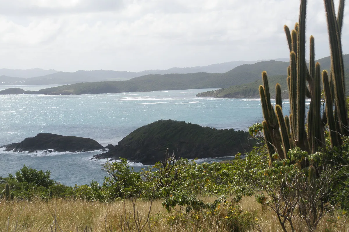
The peninsula projects into the Atlantic from La Trinité. On a single outing, the terrain moves between dry exposed vegetation, mangrove, rocky headlands and open coastal views. That contrast creates its appeal and its constraints: limited shade on some sections, slippery ground after rain and noticeable wind on high ground.
The DEAL Martinique reference page notes that the land reserve was created in 1976 and gathers the relevant regulations, including the December 2025 decree that redefined its perimeter. The lighthouse and Château Dubuc ruins add a heritage dimension, but check the rules for each space rather than treating the entire tip as one visitor site.
Short trail or long trail?
Visits are generally organised around a shorter circuit through dry forest, mangrove and the bay, and a longer one adding more Atlantic shoreline and relief. Read Martinique Tourisme’s current reserve description, then follow signs and markers on site: a saved map cannot show an incident or diversion that occurred today.
Choose the short circuit if…
- you mainly want to understand the habitats rather than accumulate kilometres;
- your group includes people unused to walking in heat;
- you are combining the reserve with Tartane or Château Dubuc;
- the forecast leaves only a short window before rain.
Short does not mean effortless. Sun, roots and mud can slow the group. Turn back before tiredness makes the return a problem.
Choose the long circuit if…
- everyone regularly walks on uneven natural ground;
- you start early enough to avoid the strongest heat;
- you carry enough water, sun protection and stable footwear;
- the forecast reports no storm, problematic wind or heavy rain.
Do not choose the long circuit merely to “make the journey worthwhile”. If cloud hides the views or a section becomes slippery, the short loop still reveals the main landscapes.
A simple strategy for the day
Walk first, then decide the remainder on site. Exposed sections are more comfortable before the heat builds. After the trail, a break in Tartane or a heritage visit requires less commitment than another sporting activity.
Do not automatically schedule a swim after hiking. The Atlantic coast changes with wind and swell. Check the Météo-France warning level and coastal marine forecast, then use only an authorised area compatible with the conditions you actually see.
Château Dubuc: place the ruins in their history
The remains are not merely a romantic backdrop. They belong to the history of a colonial sugar estate and must be approached within the context of forced labour and slavery that structured that economy. The official La Trinité guide places Château Dubuc among the municipality’s visits; current access still requires confirmation.
Check access and arrangements directly on the day. A walk in the reserve and a visit to the heritage site may not follow the same opening conditions.
Mangrove and Baie du Trésor
A mangrove is not simply an ordinary flooded forest: mangrove trees are adapted to salty, oxygen-poor soil affected by moving water. The Conservatoire du littoral describes Caravelle’s mosaic of dry forest, mangrove and protected coast.
Remain on the trail or boardwalk. Do not step into mud, break roots to pass or try to flush crabs or birds from shelter. An animal shown on an interpretation panel is never guaranteed to appear.
The recent marine extension makes current rules around Baie du Trésor especially important. For an activity on the water, do not rely on old habits: ask a professional which navigation, landing and anchoring practices are presently allowed.
Reserve rules
The official leaflet specifically states that drone overflight is prohibited. Other uses are regulated by the extension decree and applicable orders. Before any unusual activity—drone operation, professional filming, boating, anchoring, fishing or a night visit—consult the current legislation linked by the PNRM and the manager’s signs.
For an ordinary walking visit:
- remain on marked trails and close any indicated passage behind you;
- take no plant, wood, rock or shell;
- handle dogs according to posted instructions and do not assume they may enter;
- carry out all waste, including organic waste;
- watch birds from a distance without playing recorded calls;
- never cross a closure even if an old GPS trace continues beyond it.
Weather, terrain and equipment
A short shower is enough to make clay slopes slippery. Shoes with a gripping sole are more useful than beach sandals. Carry water without relying on a refill point, a hat secured against wind, sun protection and a light rain layer.
Keep an offline map on the phone, but do not let it replace waymarkers or the decision to turn back. Tell somebody your plan when walking alone and preserve enough battery for the return.
With children or limited mobility
Do not rely on the phrase “short trail”. Ask the manager about the current surface, slopes, steps and boardwalk sections. A city pushchair is not suited to a natural trail. A shorter visit with observation stops is often richer for a young child than a complete circuit in the heat.
If walking is not possible, the heritage surroundings and points reachable by car may still explain the peninsula. Confirm real accessibility before travelling because works and path conditions change.
Before taking the road
- Open the PNRM page and download the official map.
- Check warning level, rainfall and marine forecast.
- Confirm road access and closures with the manager.
- Choose the circuit for the least experienced walker in the group.
- Carry water, sun protection, footwear and an offline map.
- Keep Tartane or a heritage stop as a fallback when the trail is unsuitable.
If Caravelle is a priority, compare road times from different areas in the where to stay in Martinique guide. An Atlantic base can simplify this day but is not automatically best for south-western beaches or Saint-Pierre.
Useful points on the ground
Addresses and maps
Château Dubuc area and trailhead
La TrinitéFranceConfirm the trailhead, road access and displayed instructions before setting off.
Tartane
La TrinitéFranceA useful reference village for the peninsula; do not confuse Tartane with the final trailhead.