Volcano · Northern hike
Hiking Mount Pelée: choose the right route and turn-back plan
Mount Pelée is not a walk with a guaranteed view. Choose the slope before leaving, keep a fallback objective and decide from summit weather rather than conditions at the beach.
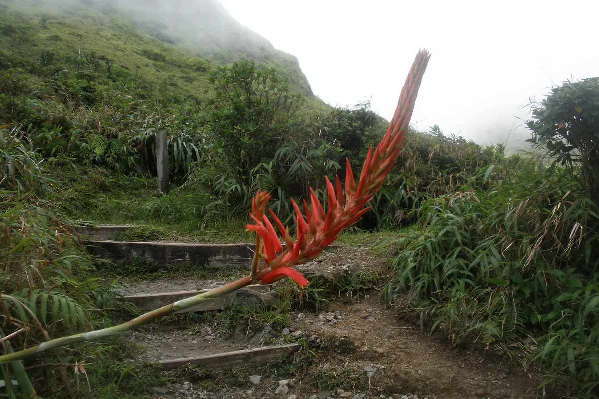
The first decision is not “how far should we climb?” but which slope to start from and which conditions mean turning back. Mount Pelée is an active volcano monitored by the Observatoire volcanologique et sismologique de la Martinique. Open terrain, domes, irregular steps and cloud cover make this a mountain outing even when the coast is hot and clear.
The UNESCO inscription of northern Martinique’s volcanoes and forests recognises both the massif’s geology and the continuity of its forests. That value is no permission to leave the route: staying on the trail protects fragile ground and avoids adding a navigation mistake to the fog.
Which route should you choose?
The three commonly mentioned approaches are not interchangeable versions of one walk. They start in different municipalities and require different driving plans.
| Approach | Who it suits | What changes the plan |
|---|---|---|
| L’Aileron, Le Morne-Rouge | A first exploration of the massif with a road-accessible trailhead that is straightforward to identify | A popular but sustained route, uneven steps, possible wind and mud, and limited parking |
| Grande Savane, Le Prêcheur side | A hiker deliberately choosing the Caribbean slope | A sunnier start, a different access road and a necessary return down the same slope |
| Morne Macouba / northern slope | An experienced hiker preparing for a longer outing | A less obvious first-ascent route whose trail condition and logistics require local confirmation |
The Comité Martiniquais du Tourisme introduces Mount Pelée’s approaches, including the popular L’Aileron trailhead. Use it to understand the variants, then check a recent map and same-day information. A downloaded GPS trace is not permission to use a closed trail.
L’Aileron: the clearest choice, not an easy shortcut
From the L’Aileron car park, the trail quickly gains open ground. That legibility explains its popularity; it removes neither the exertion nor steep sections nor the possibility of seeing nothing in cloud. A group can make the Plateau des Palmistes or second shelter its objective without continuing towards the domes.
Agree on three rules before starting: the group remains together, nobody descends alone, and the turn-back time does not move for “just a little farther”. If wind compromises balance, rain reduces grip or fog hides the next marker, descending is the useful decision.
Grande Savane: another slope and exposure
Grande Savane approaches the volcano from the Caribbean coast. Sun and heat may weigh more heavily on the opening section while the summit remains cool and wet. Carry both water and sun protection, plus a windproof layer. Do not leave a vehicle at L’Aileron and imagine improvising a traverse: return roads are long and conditions may prevent reaching the intended point.
Northern slope: plan it as a separate route
A quieter trail is not automatically a better experience. On the northern slope, likely duration, markers and ground conditions need checking before setting off. For a first day on Pelée, a qualified local professional may be wiser than blindly following a shared track.
Checks to make that morning
Open three separate sources because they answer different questions:
- Weather: check the Météo-France Antilles-Guyane warning page and a mountain forecast. A cloud icon for the municipality does not describe ridge-top wind.
- Volcano: check OVSM-IPGP updates. The alert level and prefectural instructions take priority over any hiking account.
- Access: ask the manager, tourist office or a local guide whether rain, a landslip or works have affected the road, car park or a section of trail.
Blue sky at Sainte-Anne or Les Trois-Îlets says nothing about visibility at the summit. If you cannot verify conditions in the north, keep Pelée for another day.
Equipment: prepare for the ground, not the photograph
- worn-in hiking shoes with a gripping sole;
- enough water for the group, plus a reserve that does not depend on a shop;
- sun protection, a cap and glasses for open sections;
- a light warm layer and jacket against rain and wind;
- charged phone, offline map and power bank when necessary;
- small first-aid kit, emergency blanket and food that is easy to share;
- a bag that keeps the phone, documents and warm clothing dry.
Do not rely on continuous reception. Download the map and tell somebody your selected trailhead, group, objective and expected return time. The Prefecture’s volcanic-risk page explains the civil-protection framework; it does not replace recent observatory bulletins.
Must you aim for the summit?
No. Reaching the summit is not the only valid outcome. A short outing to an early viewpoint reveals changes in vegetation and volcanic relief while preserving energy. It is often the best choice for a mixed-ability group, descending cloud or a day after another strenuous activity.
Turn back decisively when somebody is cold, loses confidence, slips repeatedly or slows enough to threaten a daylight return. Do not split the group to let faster walkers “finish”. A summit photograph does not compensate for a late descent on wet ground.
Build a fallback day
Keep two nearby plans that do not require forcing the mountain:
- descend towards Saint-Pierre to understand volcanic history through the town;
- choose an interpretation site in the north and confirm its visitor arrangements before driving;
- postpone any river activity, including Gorges de la Falaise, when rain caused you to abandon the hike.
Staying in the north shortens the road approach and lets you judge the sky without crossing the island. The where to stay in Martinique guide compares areas without promising that one municipality always has better conditions.
Sources to consult before setting out
- Martinique Tourisme — Mount Pelée and hiking approaches
- OVSM-IPGP — monitoring Mount Pelée
- Météo-France — Antilles-Guyane warnings
- UNESCO — volcanoes and forests of Mount Pelée and the northern peaks
Confirm on the day: access condition, prefectural instructions, the volcanic bulletin, recent rain, wind, visibility and every group member’s real ability.
Useful points on the ground
Addresses and maps
L'Aileron trailhead
Le Morne-RougeMartiniqueCheck road access and trail condition before climbing; a car park does not guarantee either an available space or passable conditions.
Grande Savane trailhead
Le PrêcheurMartiniqueThis western trailhead is separate from L'Aileron. Save the right point and do not change slope without rebuilding the transport plan.